Grand Manan is a Canadian island in the Bay of Fundy. Grand Manan is also the name of a incorporated village, which includes the main island and all of its adjacent islands, except White Head Island. It is governed as a village and is part of the province of New Brunswick. Take a look below for 30 fun and awesome facts about Grand Manan.
1. The point on the mainland closest to the island is near the town of Lubec, Maine, the easternmost point of the continental United States, 15 km (9.3 mi) across the Grand Manan Channel.
2. Grand Manan is 32 kilometres south of Blacks Harbour, New Brunswick.
3. “Manan” is a corruption of “mun-an-ook” or “man-an-ook”, meaning “island place” or “the island”, from the Maliseet-Passamaquoddy-Penobscot First Nations who, according to oral history, used Grand Manan and its surrounding islands as a safe place for the elderly Passamaquoddy during winter months and as a sacred burial place (“ook”-means “people of”).
4. In 1606, Samuel de Champlain, sheltered on nearby White Head Island and produced a map calling the island “Manthane”, which he later corrected to Menane or Menasne.
5. Portuguese explorer João Álvares Fagundes charted the area around 1520, but the island does not appear clearly on a map until 1558, produced by Portuguese cartographer Diogo Homem.
6. French merchant-explorer Étienne Bellenger visited the area in January 1583.
7. In 1693, the island was granted to Paul D’Ailleboust, Sieur de Périgny as part of Champlain’s “New France”.
8. D’Ailleboust did not take possession of it, and it reverted to the French Crown, in whose possession it remained until 1713, when it was traded to the British in the Treaty of Utrecht.
9. The first permanent settlement was established in 1784, when Moses Gerrish gathered a group of settlers on an area of Grand Manan he called Ross Island, in honour of settler Thomas Ross.
10. During the American Revolution, just off the island there were many naval battles between American privateers and British shipping.
11. Because of the Treaty of Paris (1783), the U.S. considered Grand Manan to be its possession due to the island’s proximity to Maine. Britain obtained title in Jay’s Treaty of 1794, while surrendering its sovereignty claims over Eastport on Moose, Frederick and Dudley islands in nearby Cobscook Bay.
12. From 1812 to 1814, the Bay of Fundy was infested with privateers who raided and plundered villages.
13. The ownership of islands in Passamaquoddy Bay was not settled until 1817, when the United States gave up its claim to Grand Manan and the surrounding islands.
14. By 1832 schools were established by the Anglican Church. While neighbouring islands along the American coast to Boston relied on whaling, Grand Manan had fishing and shipbuilding.
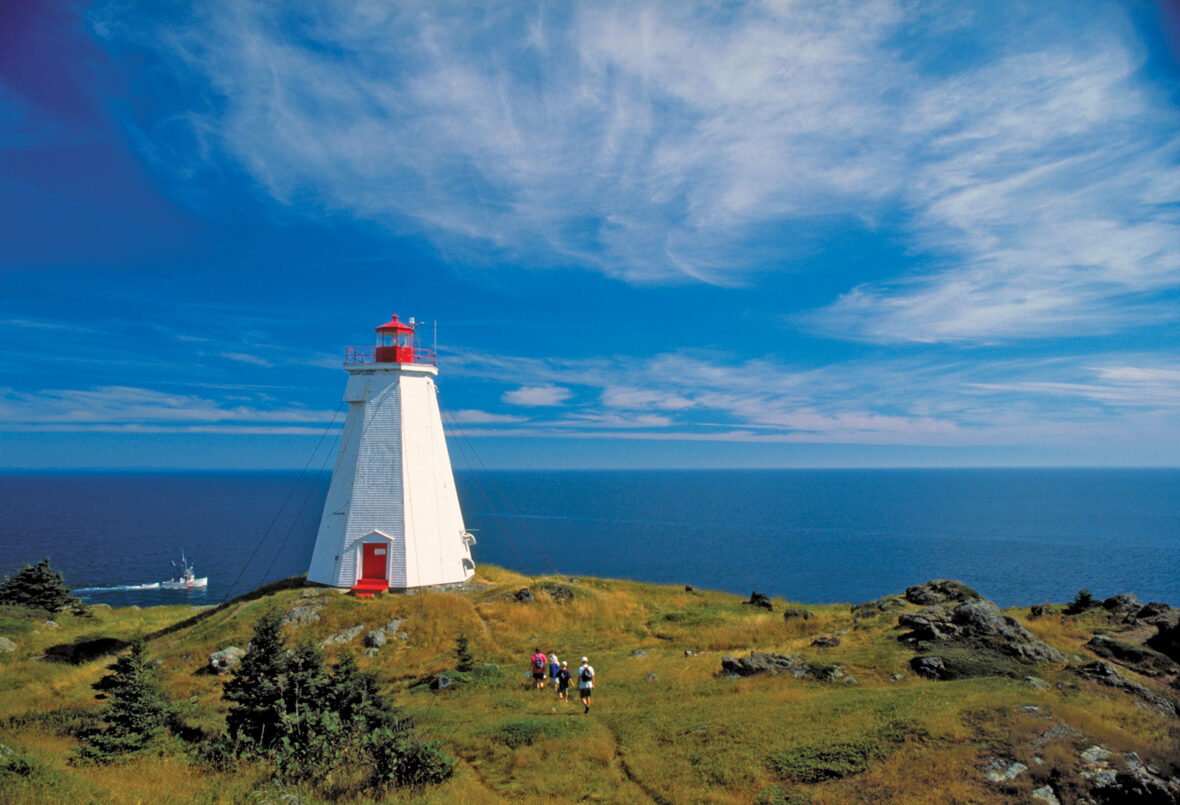
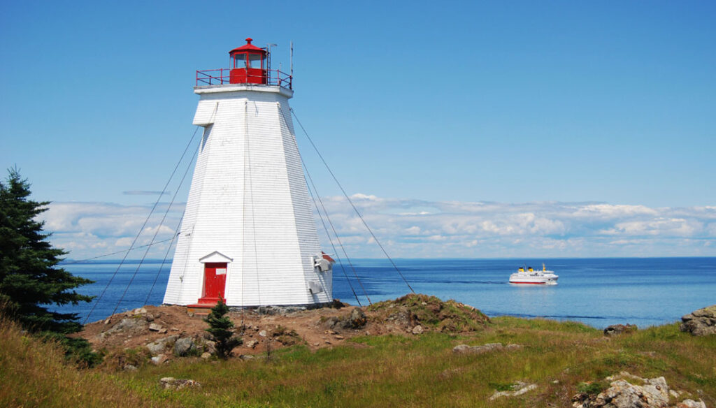
15. In 1831 the Gannet Rock Lighthouse was built on a rocky islet south of Grand Manan, to protect shipping en route to Saint John, New Brunswick. It is Grand Manan’s oldest lighthouse.
16. This period was also marked by a number of shipwrecks off the island’s rocky, cliff-lined coast. In 1857, the Lord Ashburton, was driven into the cliffs at the northern end of the island by hurricane-force winds to great loss of life.
17. Another wreck was the Nova Scotian barque Walton, which was bound for Saint John, New Brunswick, from Wales when it wrecked on the White Ledge off Grand Manan on September 14, 1878.
18. By 1851, the island population numbered almost 1,200 permanent inhabitants, most working in fishing.
19. By 1884, Grand Manan became the largest supplier of smoked herring in the world. By 1920, it produced one million boxes—or twenty thousand tons—of smoked herring, all caught in its local waters.
20. By the late Victorian era, Grand Manan had been discovered by a new breed of explorers—the “tourists”—who began visiting the island in steady numbers, weaving themselves into the fabric of its close-knit, isolated society. Pulitzer Prize–winning author Willa Cather loved the island’s unspoiled solitude, while painters such as Alfred Thompson Bricher and John James Audubon came to Grand Manan and its outlying islands to capture what they believed to be its “unique majesty”, documenting its varied geography and indigenous fauna.
21. It is the largest of the Fundy Islands, and the primary island in the Grand Manan archipelago, which also includes White Head Island, Gull Rock, Machias Seal Island, and North Rock are part of the larger Grand Manan archipelago.
22. Grand Manan is 34 km (21 mi) long and has a maximum width of 18 km (11 mi) with an area of 137 square kilometres (53 sq mi).
23. The vast majority of Grand Manan residents live on the eastern side of the island. Due to limited access, 91-metre (300 ft) cliffs, and high winds, on the western side of the island.
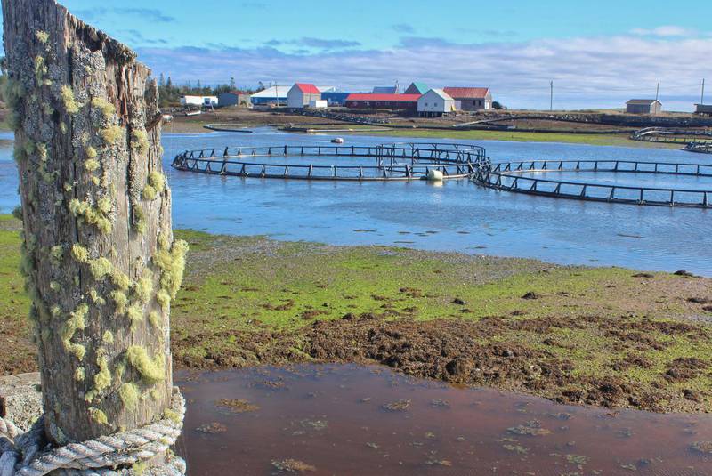
24. Grand Manan’s economy is dependent upon fishing, aquaculture and tourism. Lobster, herring, scallops and crab are most commonly sought among fishermen. Together with ocean salmon farms, dulse, rock weed and clam digging, many residents make their living “on the water”.
25. Tourism is growing significantly, providing the island with a highly profitable “green” industry. Whale and bird watching, camping and kayaking are popular activities for tourists. Visitors and retirees often purchase real-estate and remain on the island through the summer months or reside permanently as every necessary amenity exists for people of all ages.
26. Approximately 54% of the island is owned by non-residents. The community is noted for its friendly people, low crime rate, high church membership, quaint villages, and unspoiled sea-scapes. New York architect Michael Zimmer established the Sardine Museum and Herring Hall of Fame.
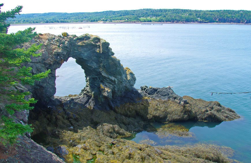
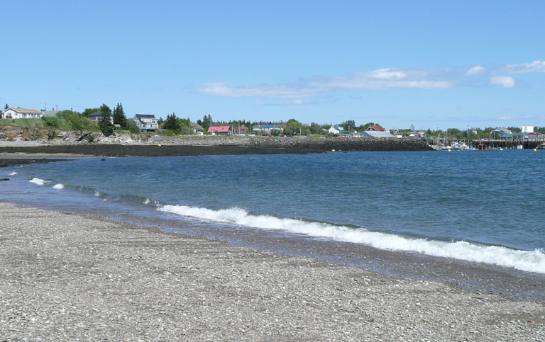
27. There are freshwater ponds, lakes and beaches that are prime locations for sunbathing, beachcombing, and picnics. Other interesting finds on Grand Manan are magnetic sand, and “The Hole-In-The Wall” located in Whale Cove in the village of North Head. Anchorage Provincial Park can be found on the island’s southeastern coast between the communities of Grand Harbour and Seal Cove.
28. As of 2016, the village had a population of 2,360. The population density was 42.26 people per square mile (16.31/km2). There were 1,298 housing units at an average density of 22.29/sq mi (8.60/km2). The racial make-up of the island was 99.17% White; and less than 1% Latin American and Aboriginal populations. Those who were third generation or more made up 89% of the population.
29. There were 1,045 households, out of which 23% had children under the age of 18 living with them. Of the 700 census families on the island, 71.42% were married couples living together. The average family size was 2.90.
30. On the island the population was spread out, with 25% age 19 or under; 5% from 20 to 24, 27% from 25 to 44, 25.4% from 45 to 64, and 17.1% at 65 years of age or older. The median age was 40.3 years.