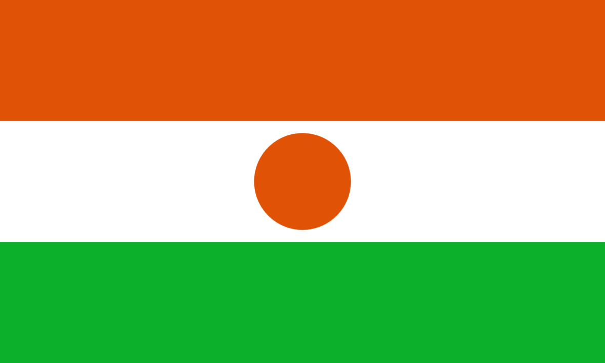
Niger, officially known as the Republic of the Niger, is a landlocked country in Western Africa named after the Niger River. Niger is bordered by Libya to the northwest, Chad to the east, Nigeria and Benin to the south, Burkina Faso and Mali to the west, and Algeria to the northwest. Take a look below for 30 more fascinating and interesting facts about Niger.
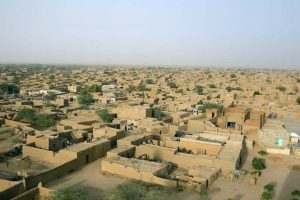
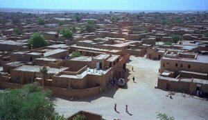
1. Zinder was the former capital of Niger before Niamey was declared as its official capital in 1926. Zinder, formerly also spelled Sinder, is the second biggest city in Niger.
2. Niger is primarily divided into seven regions and one capital district. It shares its territorial boundaries with seven other African countries.
3. It’s one of the hottest countries in the world and is famously nicknamed as the “Frying Pan of the World.” It can get hot enough to make raindrops evaporate before they even hit the ground.
4. Niger has a sub-tropical climate, with the majority of the land mass dominated by an arid, desert environment, making the country hot and dry.
5. Mount Greboun, at 5,592 feet, or 1,705 meters, is the highest point in Niger.
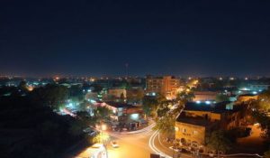
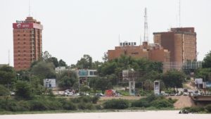
6. Niamey is the capital and biggest city of Niger. It lies on the Niger River, primarily situated on the east bank. It’s the administrative, cultural and economic center.
7. The network of protected areas in Niger covers about 17% of the national territory. It’s made up of 1 national park, 2 national nature reserves, 1 nature reserve, and other types of protected areas.
8. The W National Park is a major national park in West Africa. It’s located around a meander in the River Niger and it’s shaped like a “W.” The park includes areas of the three countries, Niger, Benin and Burkina Faso, and is governed by the three governments.
9. The Air and Tenere National Nature Reserve is a national nature reserve in Niger. It includes several overlapping reserve designations and covers both the eastern half of the Air Mountains and the western sections of the Tenere Desert.
10. The Air and Tenere UNESCO World Heritage Site was established in 1991, and marked as endangered in 1992. The entire reserve covers 77,360 square kilometers, or 29,870 square miles, which made it the second biggest nature reserve in Africa.
11. Known as the gateway to the desert, Agadez, on the southern edge of the Sahara Desert, developed in the 15th and 16th centuries when the Sultanate of Air was established and Tuareg tribes sedentarized in the city, respecting the boundaries of old encampments, which gave rise to a street pattern that’s still in place today.
12. The Grand Mosque of Niamey is an Islamic mosque located in the city of Niamey. It was built in the 1970s and it’s the biggest mosque in the city. It’s located along Islam Avenue and was funded with money from Libya.
13. The Dabous Giraffes are a neolithic petroglyph that was done by an unknown artist. It was completed between 9,000 B.C. and 5,000 B.C. The giraffe carvings were first documented by David Coulson in 1997 while on a photographic expedition at a site in Niger.
14. Through extensive archaeological research, much evidence has been found which indicates that humans have been around in northern Niger for over 600,000 years.
15. By at least the 5th century B.C., Niger became an area of trans-Saharan trade, led by the Berber tribes from the north, using camels as an adapted means of transportation through the desert.
16. One of the great empires of Africa, called the Songhai, expanded into modern day Niger until its collapse in 1591.
17. In the 19th century, contact with Europe began when the first European explorers explored the area looking for the mouth of the Niger River.
18. Even though French pacification efforts began before 1900, dissident ethnic groups, especially the desert Tuareg, were not subdued until 1992, when Niger became a French colony.
19. On July 11, 1960, agreements on national sovereignty were signed by Niger and France, and on August 3, 1960, the Republic of Niger proclaimed its independence.
20. The economy of Niger is based primarily on internal markets, subsistence agriculture, and the export of raw commodities such as foodstuffs to neighbors and raw minerals to world markets.
21. The flow of the Niger River has been described as unusual. It beings flowing 150 miles away from the Atlantic Ocean but instead of going straight to the Ocean, it curves inwards, flowing through the countries of Mali, Niger, Benin and Nigeria then finally discharges through the Niger Delta into the Gulf of Guinea.
22. The Scottish explorer, Mungo Park, was the first known Westerner to travel through the course of the Niger in 1796.
23. The official language of Niger is French. This is inherited from the colonial period and serves as an administrative language.
24. The nation is a secular state with the separation of religion and state guaranteed in the constitution. The most dominant religion practiced in Niger is Islam, with about 80% of the population identifying themselves as Muslim.
25. Indigenous communities have annual festivals with the two most prominent being the “Salt Cure” festival, which is a celebration by Tuareg nomads of the end of the rainy season.
26. The country’s last census report, which was done in 2002, indicated that 90% of the country’s workforce is in agriculture while industry and commerce employ 6% of the workforce, and the government employs the remaining 4% of citizens.
27. The nation has a single trade union federation, The Union of Worker’s Syndicate of Niger. The head of the union is appointed by the government and most members are state employees.
28. Uranium is Niger’s biggest mineral export with the country ranking fifth in uranium production globally.
29. Niger has a rich cultural history, having been home to some of Africa’s most notable empires and kingdoms. The Songhai Empire and the Mali Kingdom were domiciled in this territory.
30. Niger had had seven republics and four military regimes since its inception as a state in 1958.