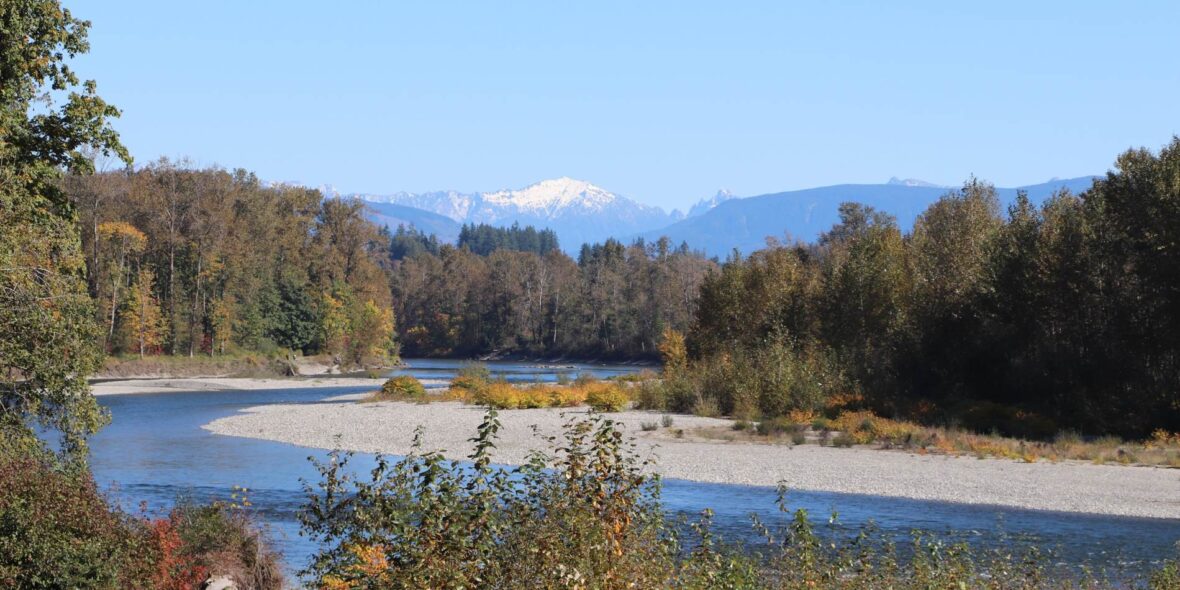
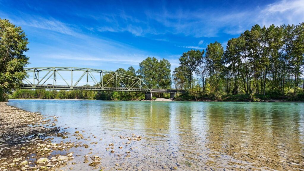
Monroe is a city in Snohomish County, Washington, United States. It is located at the confluence of the Skykomish, Snohomish, and Snoqualmie rivers in the Cascade foothills, about 30 miles (48 km) northeast of Seattle. Take a look below for 25 awesome and fun facts about Monroe, Washington, United States.
1. Monroe’s population was 17,304 as of the 2010 census and was estimated to be 19,776 in 2019.
2. Monroe was originally founded in 1864 as the town of Park Place, located at the river confluence among several existing settlements in the Tualco Valley.
3. The townsite was previously a trading post used by the indigenous Skykomish people.
4. Park Place was renamed to Monroe in 1890 to honor U.S. President James Monroe, and was moved northeast to be near the tracks of the Great Northern Railway, which was constructed in 1892.
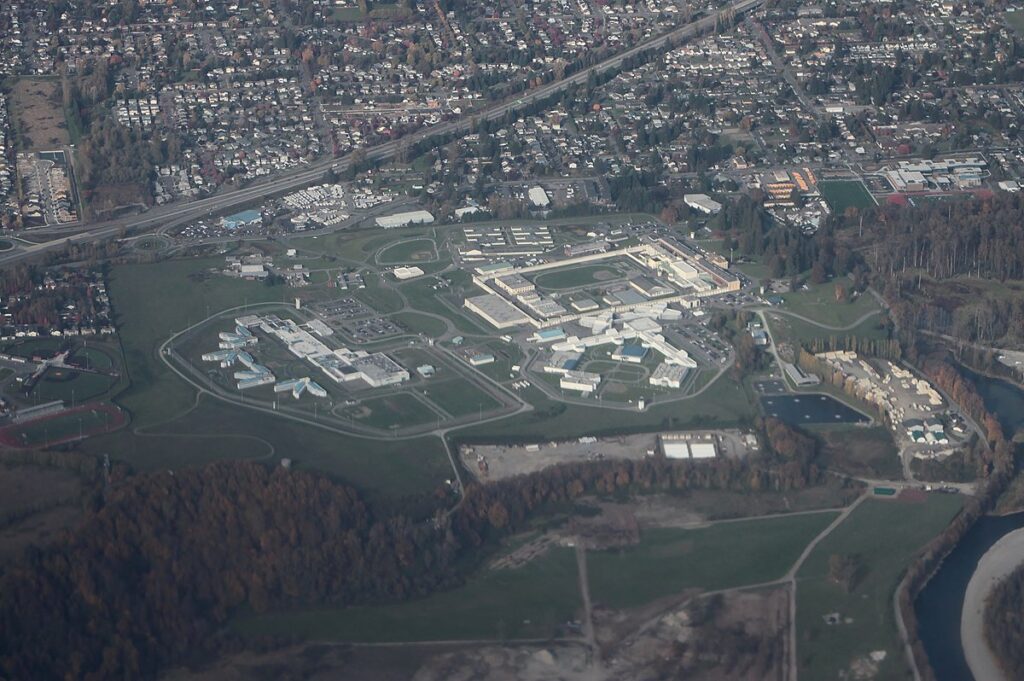
5. Monroe was incorporated in 1902 and was selected as the home of a major condensed milk plant and the state reformatory.
6. Monroe became a suburban bedroom community in the late 20th century, serving commuters to Everett, Seattle, and the Eastside.
7. It is home to the Monroe Correctional Complex, which absorbed the original reformatory in 1998, and the Evergreen State Fair, which runs annually in late summer.
8. The city is located at the junction of two highways, U.S. Route 2 and State Route 522, which were expanded in the late 20th century to serve commuters.
9. The confluence of the Skykomish and Snoqualmie rivers had originally belonged to the indigenous Skykomish tribe, who predominantly occupied the area between modern-day Monroe and Index.
10. The confluence itself was known as Tualco (Lushootseed: squa’lxo), and a nearby Skykomish village named S’dodohobc acted as a trade post between several Coast Salish groups.
11. A separate settlement near modern-day Monroe was used by the S’dodohobc band of the Snohomish people.
12. The land around the confluence was cleared into a prairie and used to cultivate berries, hazelnuts, and other plants.
13. The Skykomish were among the tribes to sign the Treaty of Point Elliott in 1855, effectively ceding their traditional territories, including the Tualco and confluence areas.
14. The area around modern-day Monroe was surveyed by George B. McClellan and the U.S. Army Corps of Engineers during their expedition to find a suitable pass for a railroad across the Cascade Mountains.
15. The Treaty of Point Elliott was not fully ratified until 1859, but the first American settlers had already arrived and claimed squatters rights to homestead in the Skykomish Valley.
16. Robert Smallman, an English immigrant, arrived in 1855 and was the first to homestead on the land around modern-day Monroe.
17. He was followed by Henry McClurg, an appointed county commissioner, who settled in the area with his wife Martha in 1860.
18. McClurg later founded the settlement of Park Place in 1864, on a site one mile (1.6 km) west of modern-day downtown Monroe.
19. Two other settlers arrived in 1860: Salem Woods, who claimed a small prairie to the northeast of Tualco and was later elected county sheriff; and Charles Harriman, a territorial legislator who settled in Park Place.
20. Park Place and Tualco, located on opposite sides of the Skykomish River, grew with the arrival of more settlers in the 1860s and 1870s.
21. A local school district, the second in the county, was established in 1869 by McClurg, and Park Place gained a post office in 1877 with Woods as postmaster.
22. A ferry crossing the Skykomish River was established in 1882, several years prior to the start of regular steamship service on the river as far east as Sultan.
23. The first roads in the area were surveyed in 1882, including an 11-mile (18 km) wagon road connecting Park Place to Snohomish in the west. During the 1880s, settlers in Park Place and Tualco received their first shipment of dairy cattle and also began planting hops, which would briefly become a cash crop until the arrival of the hop aphid and economic panic of the 1890s ruined the harvest.
24. As of the 2000 census, there were 13,795 people, 4,173 households, and 3,058 families residing in the city. The population density was 2,388.4 people per square mile (921.5/km2). There were 4,427 housing units at an average density of 766.5 per square mile (295.7/km2). The racial makeup of the city was 86.13% White, 3.15% African American, 1.32% Native American, 2.38% Asian, 0.31% Pacific Islander, 4.01% from other races, and 2.70% from two or more races. Hispanic or Latino of any race were 9.66% of the population. 21.0% were of German, 10.1% English and 9.3% Irish ancestry.
25. The median income for a household in the city was $50,390, and the median income for a family was $55,793. Males had a median income of $39,847 versus $31,633 for females. The per capita income for the city was $18,912. About 5.6% of families and 8.9% of the population were below the poverty line, including 9.2% of those under age 18 and 14.7% of those age 65 or over.