Lesotho is an enclaved country in southern Africa. The nation is over 30,000 square kilometers, or 11,583 square miles, and is completely surrounded by South Africa. It was previously known as Basutoland, but it declared independence from the United Kingdom on October 4, 1966. Take a look below for 30 more interesting and fascinating facts about Lesotho.
1. The name “Lesotho” means the land of the people who speak Sesotho.
2. Lesotho is a high altitude country as it’s situated at an elevation of 2,161 meters above sea level. It was previously known as “The Kingdom in the Sky.”
3. Thabana Ntlenyana at 3,482 meters is the highest point in the country. The junction of the Orange and Makhaleng Rivers at 1,400 meters is the lowest point in the country. It’s also the highest lowest point of any country in the world.
4. Lesotho is a mountainous country with more than 80% of the nation being 1,800 meters above sea level.
5. A major part of its population works outside the country, which is why foreign remittance plays such a significant role in its economy.
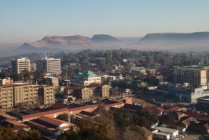
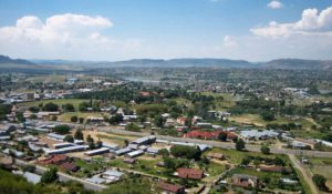
6. Maseru is the capital city of Lesotho. The city is located on the Caledon River and the name of the city means “Red Sandstones.”
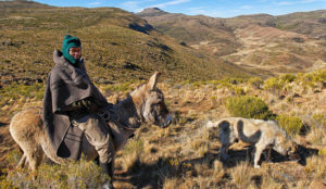
7. About 75% of the country’s population lives in rural areas. Animal herding and agriculture is the main occupation for the majority of the population.
8. Almost 90% of the goods that are consumed in Lesotho are imported from neighboring South Africa.
9. Diamond mining is a very important part of the nation’s GDP. The exporting of diamonds accounts for about 9% of Lesotho’s GDP.
10. Radio is the most popular form of media in Lesotho. The country also receives radio and television stations from neighboring South Africa.
11. The first phase of the Lesotho Highland’s Water Project was officially inaugurated in 2004. The water project is of paramount important to both Lesotho and South Africa. Lesotho extracts electrical energy from this project with the help of the hydroelectric power plant.
12. Lesotho sees 300 days of sunshine every year. The rainy season in the country is between October and April.
13. March 11th is celebrated as “Moshoeshoe Day”. This day commemorates the death of the founding father of Lesotho, Moshoeshoe I, on March 11, 1870. He was an ambassador and a great leader who worked for the country and preserve its language, art and culture.
14. Lesotho has three rivers, the Caledon River, The Orange River and the Tugela River. All of the rivers originate from the Lesotho Mountains.
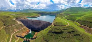
15. The Katse Dam in Lesotho second biggest double-curvature arch dam in Africa. The damn is 185 meters high and 710 meters in length. The total cost of the project was $8 billion and the dam was completed in 1996.
16. Water delivery from the Katse Dam officially began on January 22, 1998. However, the majority of the water from the dam is used by South Africa, which pays $35 million to Lesotho for the water supply.
17. Lesotho doesn’t have many forests. In fact, forests cover less than 1% of the land area.
18. Because of its elevation, the country’s climate is cooler than in most other regions at the same latitude.
19. Afriski is the only skiing resort in Lesotho. It’s located 3,050 meters, or 10,000 feet, above sea level in the Maloti Mountains, and it operates near the northern border of Lesotho and South Africa.
20. Ts’ehlanyane National Park is Lesotho’s biggest National Park. The park protects a high-altitude, 5,600 meter, or 18,400 foot, patch of rugged wilderness, including one of Lesotho’s only stands of indigenous forest with a number of rare undergrowth plants that are unique to this woodland habitat.
21. The Sehlabathebe National Park is located in the Maloti Mountains in Qacha’s Nek District, Lesotho, and is part of the bigger Maloti-Drakensberg World Heritage Site.
22. Sani Top Chalet at 2,874 meters, or 9,429 feet, above sea level is the highest pub in Africa. The put is located at the top of the Sani Pass, which is a steep trail with 27 corners and a number of tight switchbacks.
23. Even though very little of Lesotho is covered in water, the rivers that run across the country are an important part of Lesotho’s economy. A lot of the country’s export income comes from water, and a lot of its power comes from hydroelectricity.
24. Lesotho is ruled by a constitutional monarchy and is one of the three remaining kingdoms in Africa, the others being Morocco and Swaziland.
25. The country experiences harsh cold winters. The traditional dress of the Lesotho people, which is a blanket made almost entirely from wool, protects them from the freezing temperatures. The blankets often have colorful patterns and are their cultural identity as well as a status symbol.
26. Lesotho’s currency, the Lesotho Loti, is not accepted in South Africa. However, the South African Rand is accepted freely all over Lesotho.
27. The country is divided into ten districts, with each district being named after the principal town.
28. In 2016, Lesotho experienced the worst drought in more than 40 years. People were forced to eat once a day and have to walk miles to collect water for use.
29. Sesotho was one of the first African languages to develop a written form and has an extensive literature.
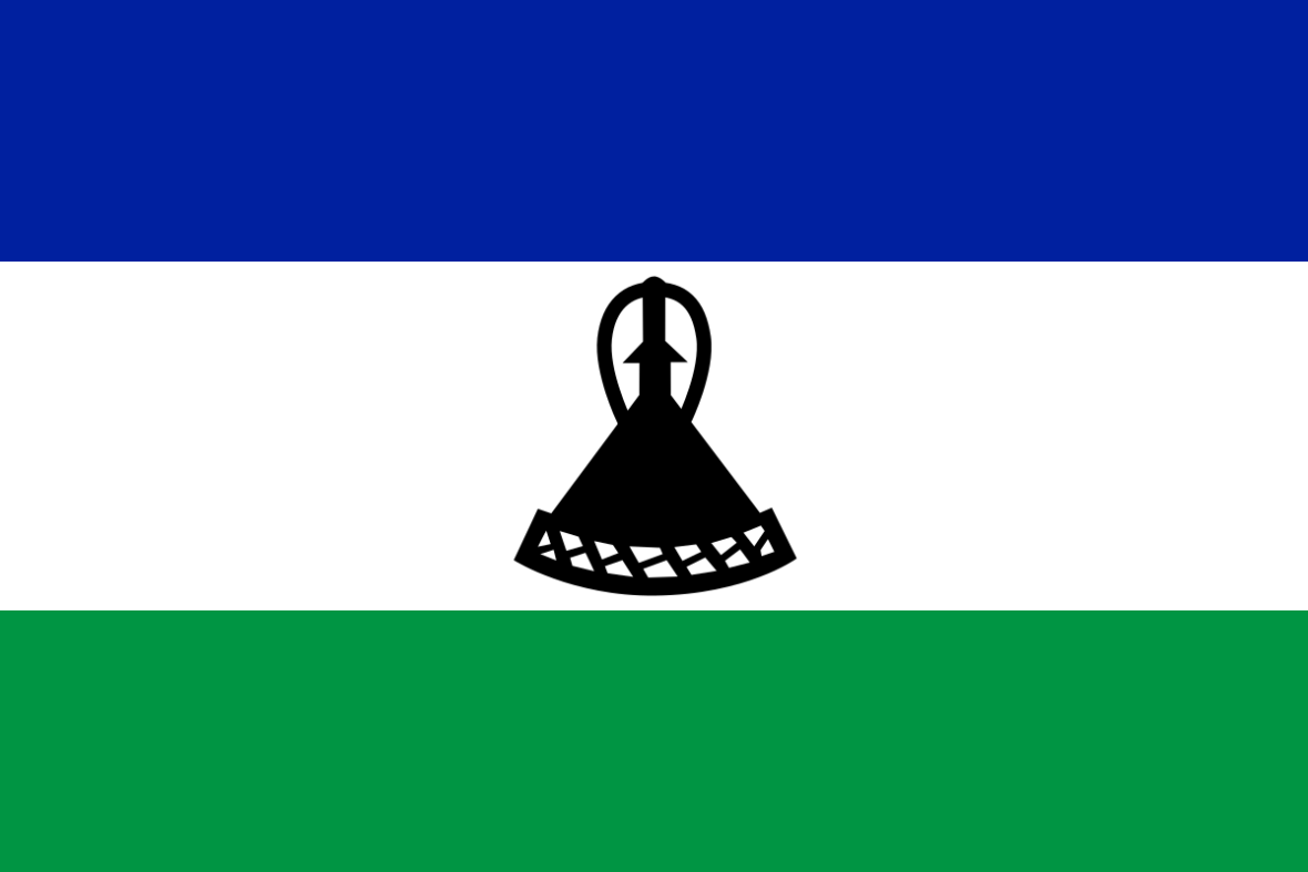
30. The Besotho hat is a famous conical woven hat with a distinctive knot at the top. The design of the hats is also featured on the national flag of Lesotho.