Independence is a city in Polk County, Oregon, United States, on the west bank of the Willamette River along Oregon Route 51, and east of nearby Monmouth. Take a look below for 20 great and interesting facts about Independence, Oregon, United States.
1. It is part of the Salem Metropolitan Statistical Area.
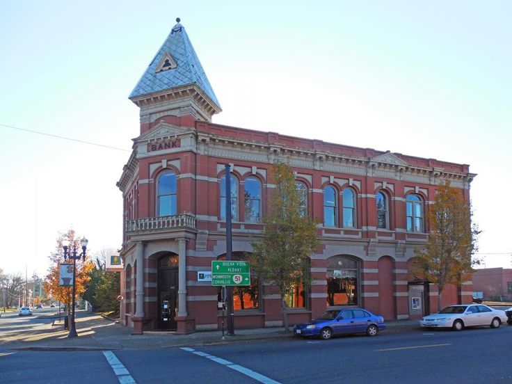
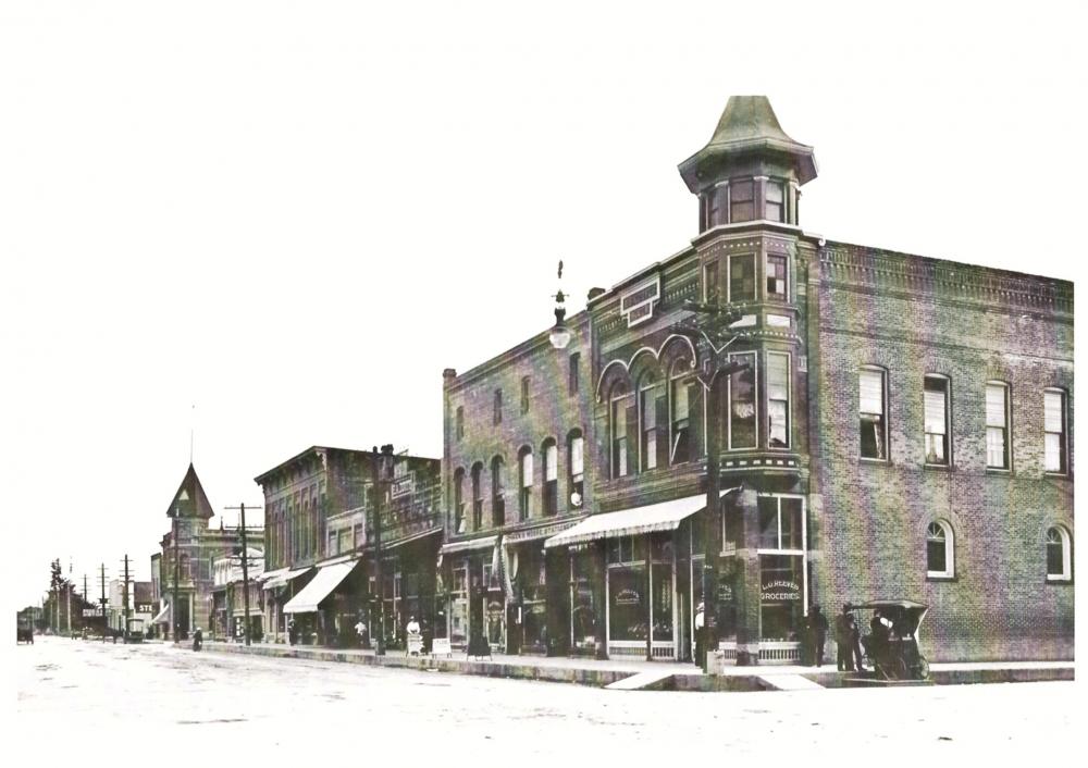
2. Thirty square blocks of the oldest part of Independence form the National Register of Historic Places-listed Independence Historic District.
3. The population was 8,590 at the 2010 census.
4. Independence was founded by pioneers who migrated from Independence, Missouri.
5. Elvin A. Thorp arrived in the Independence area in 1845 and staked a claim north of Ash Creek in June of that year.
6. He platted a small townsite that later became known as “Thorp’s Town of Independence” or the “Original Town of Independence”, now known as “Old Town”.
7. Thorp named the town for his eponymous hometown in Missouri, as well as in honor of Andrew Jackson’s characteristic of “Independence”.
8. In 1847, Henry Hill came across the plains looking for a level piece of ground on which to raise stock.
9. On November 14, 1847, he found his location on the west bank of the Willamette River (south of Ash Street) and marked off his donation land claim, which was 1 mile (1.6 km) square. In 1867, after returning from the California gold mines, Hill platted 40 acres (160,000 m2) for a townsite, thereafter to be referred to as Henry Hill’s Town of Independence.
10. The city charter bill of February 26, 1885, incorporated E.A. Thorp’s Independence and Henry Hill’s Independence. Henry Hill Elementary School was named in honor of the latter.
11. Independence thrived as a shipping point, by both rail and boat, for agricultural products and lumber until the 1950s.
12. The city was known for its hops production from the 1890s through the 1940s, hosting a festival called the “Hops Fiesta” from the early 1930s to the mid-1950s.
13. hen hop production began to decline in the early 1950s, the city’s fortunes also began to decline.
14. Downtown Independence was bypassed by major freeways in the 1960s, though the period saw an alternative form of transportation enabled by the construction of the Independence State Airport, which was dedicated on August 14, 1964.
15. As of the census of 2010, there were 8,590 people, 2,857 households, and 2,021 families residing in the city.
16. The population density was 3,146.5 inhabitants per square mile (1,214.9/km2).
17. There were 3,168 housing units at an average density of 1,160.4 per square mile (448.0/km2). The racial makeup of the city was 73.3% White, 0.4% African American, 1.8% Native American, 1.2% Asian, 0.2% Pacific Islander, 19.1% from other races, and 4.1% from two or more races. Hispanic or Latino of any race were 35.3% of the population.
18. There were 2,857 households, of which 42.0% had children under the age of 18 living with them, 51.6% were married couples living together, 12.7% had a female householder with no husband present, 6.5% had a male householder with no wife present, and 29.3% were non-families.
19. 18.6% of all households were made up of individuals, and 5.9% had someone living alone who was 65 years of age or older. The average household size was 2.99 and the average family size was 3.45.
20. The median age in the city was 28.3 years. 30.5% of residents were under the age of 18; 13.9% were between the ages of 18 and 24; 27.3% were from 25 to 44; 19.5% were from 45 to 64; and 8.7% were 65 years of age or older. The gender makeup of the city was 50.4% male and 49.6% female.