Camarillo is a city in Ventura County in the U.S. state of California. Take a look below for 20 amazing and fun facts about Camarillo, California, United States.
1. As of the 2010 United States Census, the population was 65,201, an increase of 8,117 from the 57,084 counted in the 2000 Census.
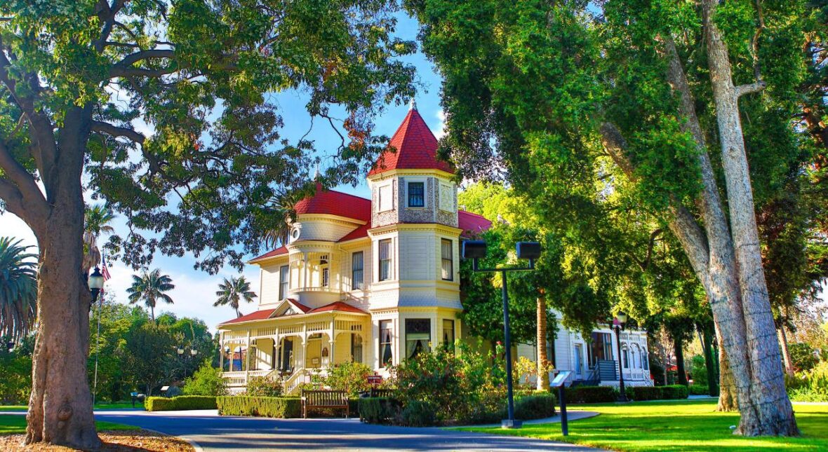
2. Camarillo is named for brothers Juan and Adolfo Camarillo, prominent Californios who owned Rancho Calleguas and founded the city.
3. The city is home to California State University, Channel Islands, housed on the former grounds of the Camarillo State Hospital.
4. At the time of European contact in the 18th century, Camarillo had been inhabited by the Chumash Indians for thousands of years.
5. Present day Camarillo and the larger Oxnard Plain were portions of a paramount Chumash capital at the village of Muwu (today’s Point Mugu).
6. Simo’mo (CA-VEN-24), which translates to “the saltbush patch”, was a Chumash village located upstream from Mugu Lagoon near the city of Camarillo.
7. Caves with ancient pictographs are located in the area around Conejo Grade including a site used for religious ceremonies dating back to 500 A.D., where two Chumash villages were located: Lalimanux (Lalimanuc or Lalimanuh) and Kayɨwɨš or Kayiwish (Kawyis) (CA-VEN-243).
8. The village of Kayɨwɨš (Chumash: “The Head”) was first encountered by Europeans of the first Portola expedition on August 16, 1795.
9. By the early 1820s, Mexico had gained independence from Spain, and shortly afterward California allied itself with Mexico. The Mexican land grant system was liberalized in 1824, resulting in many large grants in California and the proliferation of Ranchos north of the border.
10. One grant to José Pedro Ruiz created Rancho Calleguas in 1837, in the area that is now Camarillo.
11. The grant was later sold to Juan Camarillo, who had arrived in 1834 as a member of the Híjar-Padrés colony; it was his sons Adolfo and Juan that are credited with the founding of the town that was to bear their name.
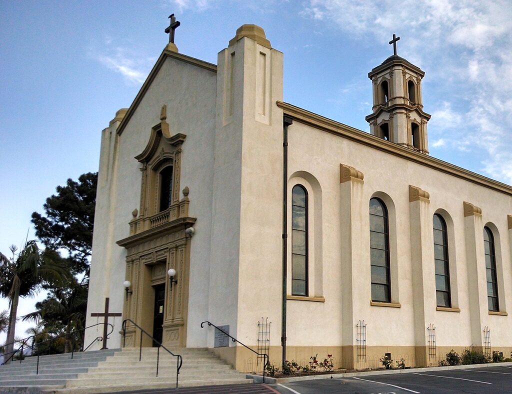
12. Around 1910, the area for the original “town site” of Camarillo was beginning to be laid out. The town was centered around St. Mary Magdalen Church, which was to serve as the family chapel for Adolfo Camarillo.
13. This area was eventually bisected by the Ventura Freeway. On the southern side of the freeway contains a strip of businesses, churches, schools, and parks.
14. In 1927 Don Juan Camarillo, brother of Adolfo, donated 100 acres (0.40 km2) to be used as a seminary to be named in honor of Saint John the Evangelist. The Roman Catholic seminary was opened in 1939 as St. John’s Seminary.
15. Camarillo’s growth was slow from founding through World War II
16. In the late 1940s, building lots on Ventura Boulevard, the main downtown street, were being offered for $450 and home lots on the adjoining streets were $250, with few buyers. Travel to and from Los Angeles was difficult, owing to the narrow, tortuous road climbing the Conejo Grade to the east of the city.
17. The main industry during this period was agriculture, and the area surrounding the small town was blanketed with orange, lemon and walnut groves. The State Mental hospital, that was built south of the town, was the largest employer. A few houses had sprung up to the north and south of town center.
18. The Oxnard Army Air Field, built during World War II to the west of town, the Naval Air Facility at Point Mugu and the Seabee base at Port Hueneme brought many military personnel to the area, but there was little private industry or other source of non-agricultural employment.
19. Oxnard AAF closed at the end of World War II, but the Navy facilities remained open, with the airfield upgraded to Naval Air Station Point Mugu and the Seabee base becoming Naval Construction Battalion Center Port Hueneme and Naval Surface Warfare Center Port Hueneme. With the Korean War and associated Cold War tensions, the former Oxnard AAF was reactivated in 1951 as Oxnard Air Force Base, an Air Defense Command / Aerospace Defense Command fighter-interceptor base, that closed again in 1970 and became the present-day Camarillo Airport.
20. In the mid-1950s, the Ventura Freeway, which bisects the town, was completed from Los Angeles to points north, making it an easy one-hour trip to Camarillo. The freeway was originally planned to follow the path of Potrero Road, south of Camarillo, which would have completely by-passed the soon-to-be city.