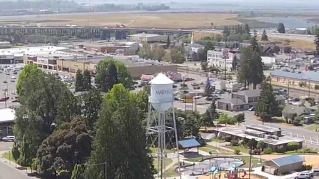
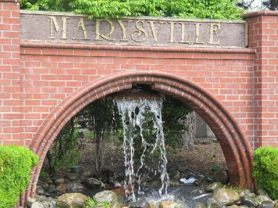
Marysville is a city in Snohomish County, Washington, United States, part of the Seattle metropolitan area. The city is located 35 miles (56 km) north of Seattle, adjacent to Everett on the north side of the Snohomish River delta. Take a look below for 30 interesting and amazing facts about Marysville, Washington, United States.
1. It is the second-largest city in Snohomish County after Everett, with a population of 60,020 in the 2010 U.S. census.
2. As of 2015, Marysville is also the fastest-growing city in Washington state, growing at an annual rate of 2.5 percent.
3. Marysville was established in 1872 as a trading post by James P. Comeford, but was not populated by other settlers until 1883.
4. After the town was platted in 1885, a period of growth brought new buildings and industries to Marysville.
5. In 1891, Marysville was incorporated and welcomed the completed Great Northern Railway. Historically, the area has subsisted on lumber and agrarian products; the growth of strawberry fields in Marysville led to the city being nicknamed the “Strawberry City” in the 1920s.
6. The city experienced its first wave of suburbanization in the 1970s and 1980s, resulting in the development of new housing and commercial areas.
7. Between 1980 and 2000, the population of Marysville increased five-fold. In the early 2000s, annexations of unincorporated areas to the north and east expanded the city to over 20 square miles (52 km2) and brought the population over 60,000.
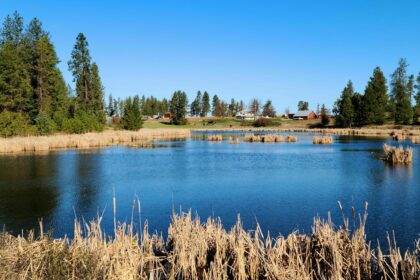
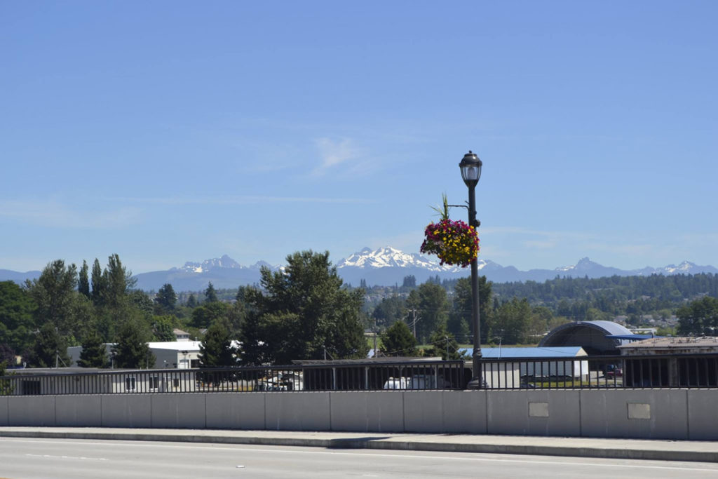
8. Marysville is oriented north–south along Interstate 5, bordering the Tulalip Indian Reservation to the west, and State Route 9 to the east. Mount Pilchuck, whose 5,300-foot-high (1,600 m) peak can be seen from various points in the city, appears in the city’s flag and seal.
9. Marysville was established in 1872 by government-appointed Indian agent James P. Comeford, an Irish immigrant who had served in the Civil War, and his wife Maria as a trading post on the Tulalip Indian Reservation.
10. The reservation, located to the west of modern-day Marysville, was established by the Point Elliot Treaty of 1855, signed by local Native American tribes and territorial governor Isaac Stevens at modern-day Mukilteo.
11. The treaty’s signing opened most of Snohomish County to American settlement and commercial activities, including logging, fishing and trapping.
12. The timber industry was the largest active industry in the area during the 1860s and 1870s, with hillsides in modern-day Marysville cleared by loggers for dairy farms.
13. The Comefords’ trading post accepted business from the reservation and logging camps that were established near the mouth of the Snohomish River.
14. In 1874, Comeford acquired three timber claims from local loggers for $450, totaling 1,280 acres (5.2 km2), and cleared the land in preparation for settlement. Comeford and his wife moved to the present site of Marysville in 1877, building a new store and wharf.
15. Although Marysville remained a one-man town until 1883, a post office and school district were both established by 1879 using the names and signatures of Native American neighbors of Comeford’s, who were given “Boston” names for the petition.
16. Comeford completed construction of a two-story hotel in 1883 to welcome new settlers from outside the region.
17. The origin of the settlement’s name, Marysville, remains disputed. According to the Marysville Historical Society, it was to be named Mariasville for Maria Comeford, but was changed to Marysville after the postal department identified a similarly-named town in Idaho.
18. Among the first residents to arrive in the area in the 1880s were James Johnson and Thomas Lloyd, who allegedly suggested that the town be named for their previous home of Marysville, California.
19. Comeford sold his store and wharf to settlers Mark Swinnerton and Henry B. Myers in 1884, and moved north to the Kellogg Marsh (now part of Marysville) to farm 540 acres (220 ha) of land he purchased.
20. Marysville was formally platted on February 25, 1885, filed by the town physician J. D. Morris and dedicated by the Comefords.
21. More settlers began to arrive after the completion of the town’s first sawmill in 1887, joined by three others by the end of the decade.[5] Marysville was officially incorporated as a fourth-class city on March 20, 1891, with a population of approximately 400 residents and Mark Swinnerton serving as the city’s first mayor.
22. The Great Northern Railway also completed construction of its tracks through Marysville in 1891, building a drawbridge over Ebey Slough and serving the city’s sawmills.
23. A newspaper named the Marysville Globe was established by Thomas P. Hopp in 1892 and continues to be published in the city.
24. By the turn of the century, the city’s population had grown to 728, and social organizations began to establish themselves in Marysville, including a lodge of the Independent Order of Odd Fellows and a Crystal Lodge of the Free and Accepted Masons.
25. The first city hall was opened in late 1901, at a cost of $2,000; the building also housed the city’s fire department, and later the first public library in 1907. Electrical and water supply systems were both inaugurated in 1906, alongside the construction of a high school building.
26. The timber industry in Marysville peaked in 1910, at which point the city’s population reached 1,239, with 10 sawmills producing lumber on the shores of Ebey Slough. Agriculture began to grow in Marysville, with its fertile land suited for the growing of strawberries in particular. By 1920, the city had more than 2,000 acres (810 ha) of strawberry fields, leading to the coining of the city’s nickname of “Strawberry City” and the establishment of the annual Strawberry Festival in 1932.
27. An automobile bridge across Ebey Slough and the Snohomish River estuary to Everett was completed in 1927, with funding from the state department of highways to complete the Pacific Highway (later part of U.S. Route 99, and present-day State Route 529).
28. The city remained relatively unchanged through the Great Depression, with the diversity of industries credited for Marysville avoiding the worst of economic hardship experienced by other nearby communities. During World War II, an ammunition depot was built on the Tulalip Reservation near present-day Quil Ceda, later being re-used as a Boeing test site after the aerospace company expanded in Everett.
29. The Red Curtain Foundation for the Arts was founded in 2009 to offer art, music and theatre classes in Marysville, including the staging of community theatre productions. The Red Curtain renovated a former lumber store in 2012 to house a community arts center, but moved in 2015 to a new location at a shopping center in central Marysville in 2015, which will be renovated into a 10,000-square-foot (930 m2) arts center with a 130-seat theatre, classrooms, and other amenities.
30. Marysville was formerly home to a children’s museum from 1993 to 1995, located at the Marysville Towne Center Mall.