Mozambique is a southern African nation whose long Indian Ocean coastline is dotted with popular beaches like Tofo, as well as offshore marine parks. In the Quirimbas Archipelago, a 250 kilometer stretch of coral islands, mangrove covered Ibo Island has colonial era ruins surviving from a period of Portuguese rule. Take a look below for 30 more fascinating and interesting facts about Mozambique.
1. Mozambique’s economy is based largely on agriculture, but industry, mainly food and beverages, chemical manufacturing, aluminum and petroleum production, is growing.
2. The country is drained by five principal rivers and several smaller ones with the biggest and most important being the Zambezi.
3. The nation is forecast to be one of the fastest growing countries in the next 10 years, largely helped by exports of coal and natural gas.
4. The biggest island in the archipelago, Bazaruto Island, is about 23 miles, or 37 kilometers, long and 4 miles, or 7 kilometers, wide. It’s surrounded by massive stretches of white sand and enormous sand dunes.
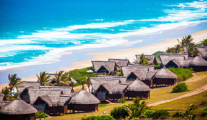
5. Benguerra is the second biggest island of the Bazaruto Archipelago, and it’s less than half a mile, or 1 kilometer, south of Bazaruto and, much like its neighbor, has stunning beaches, big sand dunes and freshwater lakes.
6. Often referred to as, “the place where Noah parked his Ark,” Gorongosa National Park was a playground for the rich and famous in the 1960s, who were lured by the parks abundance of wildlife and natural beauty. However, the years of war and poaching decimated the wildlife and the park doesn’t look anything like it did back then.
7. The Niassa Game Reserve is the biggest protected area in Mozambique, and one of the most pristine wilderness areas in Africa.
8. The country is divided into two topographical regions by the Zambezi River. To the north of the Zambezi River, a narrow coastline and bordering plateau slop upward into hills and a series of rugged highlands punctuated by scattered mountains.
9. To the south of the Zambezi River, the lowlands are broader with the Mashonaland plateau and Lebombo Mountains located in the deep south.
10. Monte Binga is the highest mountain in Mozambique and the second highest mountain in Zimbabwe. It’s located right at the border between Zimbabwe and Mozambique in the Chimanimani Transfrontier Park in the province of Manica. It’s height is 2,440 meters, or 8,004 feet, above sea level.
11. The network of protected areas in Mozambique covers about 22% of the national territory. It’s made up of 6 national parks, and other types of protected areas.
12. The Island of Mozambique is found off northern Mozambique, between the Mozambique Channel and Mossuril Bay. It’s party of the Nampula Province and, prior to 1898, it was the capital of colonial Portuguese East Africa.
13. The Chapel of Nossa Senhora de Baluarte is located on the eastern tip of the island of Mozambique. It was built by the Portuguese in 1522 and is considered to be the oldest European building in the southern hemisphere.
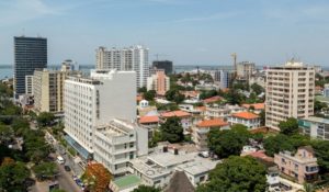
14. The Church of San Antonio de la Polana is a religious building located in the city of Maputo. The church was built in 1962 and is shaped like an inverted flower.
15. The Maputo Elephant Reserve is home to a herd of 350 elephants, whose habitat was under threat.
16. Polygamy is traditionally practiced and, until recently, was quite common. In 1981, Frelimo instituted a law designed in conjunction with OMM that established monogamous marriage.
17. Some of the richest coral reefs are in Mozambique. There are over 1,200 species of fish that have been identified in the coastal waters of the country.
18. There are 147 airports in Mozambique, although only 22 have tar runways.
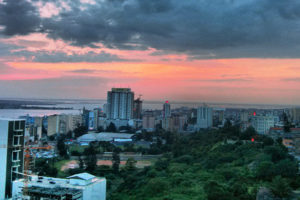
19. Maputo in Mozambique is known as the City of Acacias, in reference to acacia trees that are commonly found along its avenues.
20. The country has a tropical climate that can produce heavy flooding along the rivers. In 2001, flooding along the Zambezi River valley forced 70,000 people to flee their homes, and the World Bank estimated that a total of 491,000 were displaced by floods throughout the country.
21. Bantu speakers migrated to Mozambique in the first millennium, with Arab and Swahili traders settling in the region after.
22. Mozambique was explored by Vasco de Gama in 1498 and first colonized by Portugal in 1505. By 1510, the Portuguese had control of all the former Arab sultanates on the east African coast.
23. Guerrilla activity began in 1963, and become so effective that by 1973, Portugal had to dispatch 40,000 troops to fight the rebels. A cease-fire was signed in September, 1974, within independence being given on June 25, 1975.
24. The diet of rural residents is based on the cassava root, which is called mandioca in Portuguese. Its importance is testified to by its name, which translates as “the all sufficient.” The food can be baked, dried in the sun, or mashed with water to form porridge.
25. Greetings are length and involve inquiring into the health of each other’s family. People from Mozambique generally stand close together and are physically affectionate.
26. The animism practiced in Mozambique includes sorcerers, wise men and women, and witch doctors or traditional healers, who are “capable” of communicating with spirits and act as go-betweens for the rest of the people.
27. Wind instruments known as lupembe, which are used by the Makonda tribe, are made from animal horns, wood or gourds.
28. The marimba, which is a kind of xylophone that has been adopted in Western music, originated in Mozambique, where it’s popular with the Chopi tribe in the south.
29. Chopi musicians also use the mbira, which are strips of metal attached to a hollow box and plucked with the fingers. The musical style is similar to West Indian calypso and reggae.
30. In the northern coastal region and islands of Mozambique, it’s common to see women with faces covered with a natural white mask, called mussiro or n’siro. According to oral accounts, mussiro masks were used to carry out subliminal messages related to the civil status of the women.

