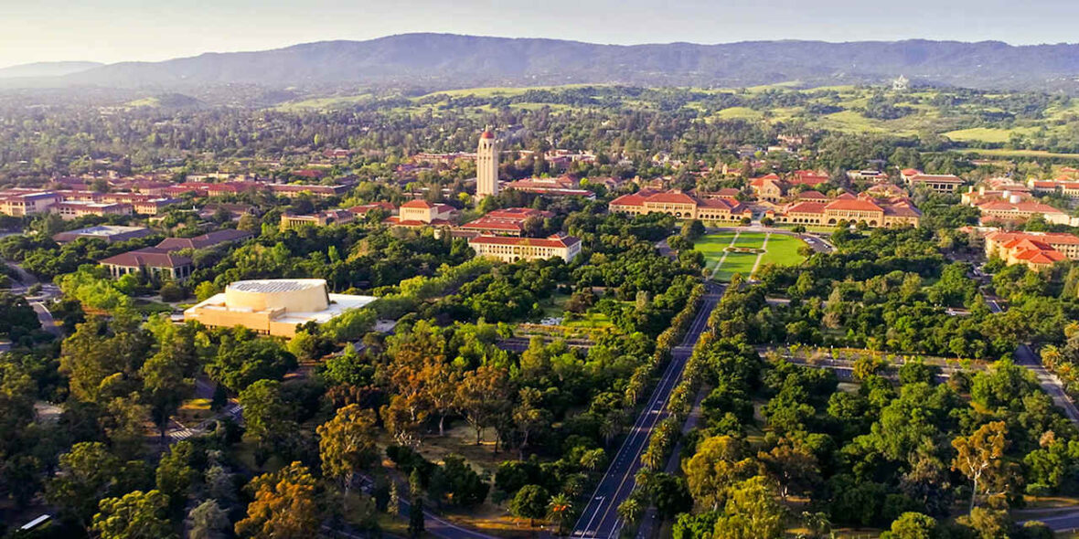
Palo Alto is a charter city located in the northwestern corner of Santa Clara County, California, United States, in the San Francisco Bay Area. Take a look below for 20 amazing and awesome facts about Palo Alto, California, United States.
1. The city is named after a coastal redwood tree known as El Palo Alto.
2. The city was established by Leland Stanford when he founded Stanford University, following the death of his son, Leland Stanford Jr. Palo Alto includes portions of Stanford University and shares its borders with East Palo Alto, Mountain View, Los Altos, Los Altos Hills, Stanford, Portola Valley, and Menlo Park.
3. At the 2020 census, the city’s total resident population was 68,572.
4. Palo Alto is one of the most expensive cities in the United States in which to live and its residents are among the most educated in the country. However, the city has a youth suicide rate four times higher than the national average, often attributed to academic pressure.
5. As one of the principal cities of Silicon Valley, Palo Alto is headquarters to a number of high-technology companies, including Hewlett-Packard (HP), Space Systems/Loral, VMware, Ford Research and Innovation Center, PARC, IDEO, Skype, Houzz, and Lockheed Martin Advanced Technology Center.
6. Palo Alto has also served as an incubator and was headquarters to several other prominent high-technology companies, including Apple, Google, Facebook, Logitech, Intuit, Pinterest, and PayPal.
7. Prior to the arrival of Europeans, the Ohlone lived on the San Francisco peninsula; in particular, the Puichon Ohlone lived in the Palo Alto area.
8. The area of modern Palo Alto was first recorded by the 1769 party of Gaspar de Portolá, a 64-man, 200-horse expedition setting out from San Diego to find Monterey Bay.
9. The group trekked past the bay without recognizing it and continued north.
10. When they reached modern-day Pacifica, they ascended Sweeney Ridge and saw the San Francisco Bay on November 2.
11. Portolá descended from Sweeney Ridge southeast down San Andreas Creek to Laguna Creek (now Crystal Springs Reservoir), thence to the San Francisquito Creek watershed, ultimately camping from November 6–11, 1769, by a tall redwood later to be known as El Palo Alto.
12. In 1777, Father Junipero Serra established the Mission Santa Clara de Asis, whose northern boundary was San Francisquito Creek and whose lands included modern Palo Alto. The area was under the control of the viceroy of Mexico and ultimately under the control of Spain.
13. On November 29, 1777, Pueblo de San Jose de Guadalupe (now the city of San Jose a few miles to the south of what was to be Palo Alto) was established by order of the viceroy despite the displeasure of the local mission. The Mexican War of Independence ending in 1821 led to Mexico becoming an independent country, though San Jose did not recognize rule by the new Mexico until May 10, 1825. Mexico proceeded to sell off or grant much of the mission land.
14. During the Mexican–American War, the United States seized Alta California in 1846; however, this was not legalized until the Treaty of Guadalupe Hidalgo was signed on July 4, 1848. Mexican citizens in the area could choose to become United States citizens and their land grants were to be recognized if they chose to do so (though many legal disputes arose over this).
15. The land grant, Rancho Rinconada del Arroyo de San Francisquito, of about 2,230 acres (9.0 km2) on the lower reaches of San Francisquito Creek (i.e., parts of modern Menlo Park and northern Palo Alto) was given to Maria Antonia Mesa in 1841. She and her husband Rafael Soto (who had died in 1839) had settled in 1835 near present-day Newell and Middlefield roads and sold supplies.
16. In 1839, their daughter María Luisa Soto (1817–1883) married John Coppinger, who was to be, in 1841, the grantee of Rancho Cañada de Raymundo (in modern San Mateo county). Upon Coppinger’s death in 1847, Maria inherited it and later married a visiting boat captain, John Greer. Greer owned a home on the site that is now Town & Country Village on Embarcadero and El Camino Real. Greer Avenue and Court are named for him.
17. To the south of the Sotos, the brothers Secundino and Teodoro Robles in 1849 bought Rancho Rincon de San Francisquito from José Peña, the 1841 grantee. The grant covered the area south of Rancho Rinconada del Arroyo de San Francisquito to more or less present-day Mountain View. The grant was bounded on the south by Mariano Castro’s Rancho Pastoria de las Borregas grant across San Antonio Road.
18. This later became the Robles Rancho, which constitutes about 80% of Palo Alto and Stanford University today. In 1863, it was whittled down in the courts to 6,981 acres (28.25 km2). Stories say the grand hacienda was built on the former meager adobe of José Peña near Ferne off San Antonio Road, midway between Middlefield and Alma Street.
19. Their hacienda hosted fiestas and bull fights. It was ruined in the 1906 earthquake and its lumber was used to build a large barn nearby, which was said to have lingered until the early 1950s. On April 10, 1853, 250 acres (1.0 km2), comprising the present-day Barron Park, Matadero Creek and Stanford Business Park, was sold for $2,000 to Elisha Oscar Crosby, who called his new property Mayfield Farm. The name of Mayfield was later attached to the community that started nearby. On September 23, 1856, the Crosby land was transferred to Sarah Wallis to satisfy a debt he owed her.
20. In 1880, Secundino Robles, father to twenty-nine children, still lived just south of Palo Alto, near the location of the present-day San Antonio Shopping Center in Mountain View.


