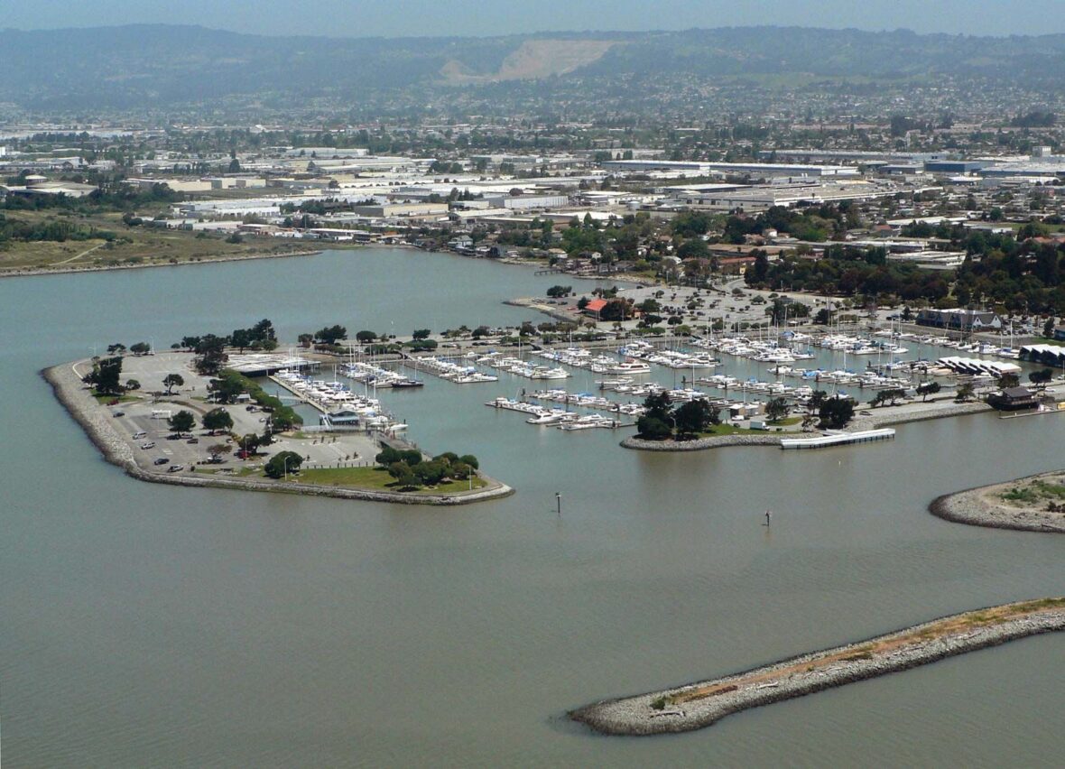
San Leandro (Spanish for “St. Leander”) is a city in Alameda County, California, United States. Take a look below for 20 interesting and amazing facts about San Leandro, California, United States.
1. It is located in the East Bay of the San Francisco Bay Area, located between Oakland to the northwest and Ashland to the southeast.
2. The population was 91,008 as of the 2020 census.
3. The first inhabitants of the geographic region that would eventually become San Leandro were the ancestors of the Ohlone people, who arrived sometime between 3500 and 2500 BC.
4. The Spanish settlers called these natives Costeños, or ‘coast people,’ and the English-speaking settlers called them Costanoans.
5. San Leandro was first visited by Europeans on March 20, 1772, by Spanish soldier Captain Pedro Fages and the Spanish Catholic priest Father Crespi.
6. San Leandro is located on the Rancho San Leandro and Rancho San Antonio Mexican land grants. Its name refers to Leander of Seville, a sixth-century Spanish bishop.
7. Both land grants were located along El Camino Viejo, modern 14th Street / State Route 185.
8. The smaller land grant, Rancho San Leandro, of approximately 9,000 acres (3,600 ha), was given to José Joaquín Estudillo in 1842. The larger, Rancho San Antonio, of approximately 44,000 acres (18,000 ha), was given to another Spanish soldier, Don Luis Maria Peralta, in 1820.
9. Beginning in 1855, two of Estudillo’s sons-in-law, John B. Ward and William Heath Davis, laid out the townsite that would become San Leandro, bounded by the San Leandro Creek on the north, Watkins Street on the east, Castro Street on the south, and on the west by the longitude lying a block west of Alvarado Street.
10. The city has a historical Portuguese American population dating from the 1880s, when Portuguese laborers from Hawaii or from the Azores began settling in the city in and established farms and businesses. By the 1910 census, they had accounted for nearly two-thirds of San Leandro’s population.
11. In 1856, San Leandro became the county seat of Alameda County, but the county courthouse was destroyed there by the devastating 1868 quake on the Hayward Fault.
12. The county seat was then re-established in the town of Brooklyn (now part of Oakland) in 1872.
13. During the American Civil War, San Leandro and its neighbor, Brooklyn, fielded a California militia company, the Brooklyn Guard.
14. San Leandro was one of a number of suburban cities built in the post–World War II era of California to have restrictive covenants, which barred property owners in the city from selling properties to African Americans and other minorities.
15. As a result of the covenant, In 1960, the city was almost entirely white (99.3%), while its neighbor city of Oakland had a large African American population.
16. The United States Supreme Court, in Shelley v. Kraemer, later declared such covenants unenforceable by the state. San Leandro was an 86.4% white-non Hispanic community according in the 1970 census.[18] The city’s demographics began to diversify in the 1980s.
17. By 2010, Asian Americans had become a plurality population in San Leandro, with approximately one-third of the population, with non-Hispanic Whites accounting for 27.1% of the population.
18. The San Leandro Hills run above the city to the northeast. In the lower elevations of the city, an upper regionally contained aquifer is located 50 to 100 feet (15 to 30 m) below the surface. At least one deeper aquifer exists approximately 250 feet (75 m) below the surface. Some salt water intrusion has taken place in the San Leandro Cone.
19. Shallow groundwater generally flows to the west, from the foothills toward San Francisco Bay. Shallow groundwater is contaminated in many of the locales of the lower elevation of the city. Contamination by gasoline, volatile organic compounds and some heavy metals has been recorded in a number of these lower-elevation areas.
20. The trace of the Hayward Fault passes under Foothill Boulevard in San Leandro. Follow the link in the reference to see a series of photos of the fault cutting the asphalt between 1979 and 1987.


