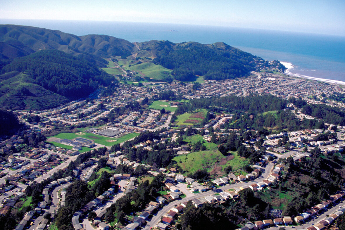
Pacifica is a city in San Mateo County, California, on the coast of the Pacific Ocean between San Francisco and Half Moon Bay. Take a look below for 15 amazing and fun facts about Pacifica, California, United States.
1. The City of Pacifica is spread along a 6-mile (9.7-kilometer) stretch of coastal beaches and hills in north central California.
2. The city comprises several small valleys spread between Sweeney Ridge in the east, Montara Mountain to the south, and the Pacific Ocean’s rocky bluffs to the west.
3. Pacifica is well known regionally as a popular surfing destination.
4. Surfers and families often visit Linda Mar Beach. Rockaway Beach is a scenic location and offers recreation, shopping and dining.
5. 2005 marked the opening of the top ranked Pacifica Skateboard Park. Pacifica is also a popular mountain biking destination, with many trails crossing the hillsides that surround the city, including Pedro Mountain Road, Sweeney Ridge, and areas of the Golden Gate National Recreation Area.
6. Fishermen frequent the local beaches and the Pacifica Pier, often catching striped bass and salmon. Pacifica is also a popular place to hike, with many trails that wind along the beaches and bluffs, including Mori Point, San Pedro Valley County Park, the Sanchez Adobe, Milagra Ridge, and the privately owned Pacifica quarry.
7. For live local theater and performing arts, Pacifica Spindrift Players is a local and popular favorite, in addition to Pacifica Performances which regularly provides both musical presentations and performing arts as well. Pacifica is also home to the Sharp Park Golf Course, which was designed in 1931 by architect Alister MacKenzie.
8. The world class bromeliad nursery, Shelldance Orchid Gardens is located just off Highway 1 in Pacifica, adjacent to the Sweeney Ridge hiking trailhead.
9. Before European settlers arrived, Pacifica was home to two significant Ohlone Indian villages: Pruristac located at San Pedro Creek near present-day Adobe Drive, and Timigtac on Calera Creek in the Rockaway Beach neighborhood.
10. Pacifica is the location of the oldest European encounter with the San Francisco Bay. An expedition led by Gaspar de Portolà sighted the bay by climbing the hills of Sweeney Ridge in Pacifica on November 4, 1769.
11. Before then, earlier Spanish maritime explorers of the California coast Juan Cabrillo and Sebastian Vizcaino had missed the San Francisco Bay because heavy fog so frequently shrouded its entrance from the Pacific Ocean (the Golden Gate).
12. Sighting the San Francisco Bay accelerated the Spanish colonization of Alta California because it was the only large, safe, centrally located harbor on the Alta California coast. The Spanish had known about Monterey Bay since the sixteenth century, but, unlike San Francisco Bay, it was too exposed to rough currents and winds to be used as major harbor for their trade between Asia and Mexico.
13. In the Spanish era, Pacifica was the site of the San Pedro Valley Mission Outpost (1786–1793) of Mission Dolores. That was dissolved when a newly independent Mexico secularized the mission system. Pacifica is also the site of the still-extant Mexican-era Sánchez Adobe, built in 1846. The city is located on a part of the Mexican land grant Rancho San Pedro given to Francisco Sanchez in 1839.
14. During World War II, the area around the present-day Sharp Park recreational area held the Sharp Park Detention Center, an INS processing facility for Japanese Americans, Japanese nationals, and other “foreign enemies” during Japanese internment.
15. The Stanford professor Yamato Ichihashi spent six weeks in Sharp Park. He described the facility, writing, “The ground is limited by tall iron net-fences and small in area; barracks 20′ x 120′ are well-built and painted outside and inside and are regularly arranged; there are 10 of these for inmates, each accommodating about 40, divided into 5 rooms for 8 persons each; if double-decked (beds), 80 can be put in.”


